Stanpit Marsh and Nature Reserve
Stanpit Marsh covers nearly a 130 acres (52 hectares) of low lying land just beyond the confluence of the rivers Avon and Stour at the Western end of Christchurch Harbour. Due to its level it is liable to flood and has as a result has stayed relatively unscathed by human exploitation. In the past, the northern end was used as a rubbish dump and the area has been utilised by the military in both world wars as a testing ground and exercise area, mainly for military engineering. In fact Stanpit Marsh boasts the oldest and one of the few remaining WW II Bailey bridges. The prototype Bailey bridge was used to span Mother Sillers Channel and remains there to this day. Other areas of the Marsh have been reclaimed for a golf course but otherwise Stanpit Marsh has largely been left to itself. Due to its position the Marsh attracts many varied and often rare species of birds and there is a very popular and active local ornithological group (in fact no longer limited to birds!) See www.chog.org.uk
Stanpit Marsh also has a group of local supporters who look after this special place and also provide a summer warden and information to visitors. Find out about the unique status of the Stanpit Marsh Nature Reserve in Christchurch and of the work and activities of the Friends of Stanpit Marsh and how you can get involved http://www.friendsofstanpitmarsh.org.uk
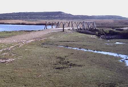
The Bailey Bridge on Stanpit Marsh, This is the original WWII Bailey bridge prototype and straddles Mother Sillers Channel. Designed and built locally in Christchurch
There is a free car park at the northern end of the marsh which is about 50 yards east of The Ship In Distress Public house in Stanpit village. Usually the prepared paths on the marsh are dry and make for an easy and un-muddy walk while still allowing the rambler to enjoy the environment. A circular route around the marsh takes you down to the Bailey bridge across Mother Sillers channel and then down to the confluence of the two rivers, from then if you head upriver along the river beach and then back inland over improvised railway sleeper bridges, past an old long abandoned iron lifeboat, past the back of the golf course and back across the open playing field. The playing field itself, is a small victory for reclamation as 50 years ago it was used as a waste dump. Its undulating surface still tells of a continual settling.
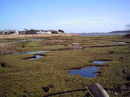
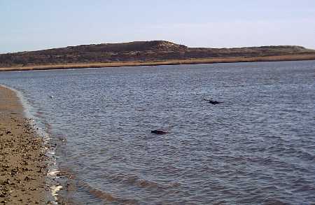
Near the car park, looking east towards Mudeford Creek and Strides Boatyard
Mudeford Creek is a dead end that butts up to Stanpit Marsh. Mudeford Creek dries every low tide. Strides Yard, at the eastern end of Mudeford Creek is a long established local Boat yard and is also the home for a Dutch Barge that is the home of Mudeford Sailing Club.
Stanpit marsh has been formed as a direct result of action and deposition of material from the twin rivers as they flow down and meet with the salt sea water within Christchurch Harbour.
The marsh is geologically speaking, relatively new and the oldest parts date back about 10000 years. During this time it has changed considerably and today continues to evolve. The highest point is an ancient grass covered sand dune know as Crouch Hill. Crouch Hill quite near the Bailey bridge and tops out at 5 meters above sea level. To the east of Crouch hill lies Blackberry Point. Forty years ago this was a small island within Christchurch Harbour known locally as Horseshoe Island. Today, I understand, it is more firmly attached to the marsh.
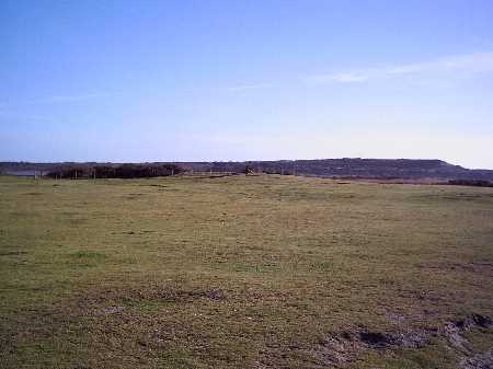
The uninspiring fenced mound in the middle is Crouch Hill,the highest point on Stanpit marsh. Hengistbury Head looms large in the background
The Bailey Bridge was designed and built at the nearby Military Experimental Establishment (MEXE) situated at Bargates in ChristchurchThis type of light durable bridge was a vital innovation during WWII. it allowed allied forces to make quick progress across Europe after D-Day.
The eastern end of Mother Sillers Channel ends at Speillers Point. The wide entrance of Mother Sillers Channel comes up to the bridge through an area known as Gimmery Marsh and then winds darkly into the marsh reeds, before petering out. In the 18/19th century the channel was navigable for small vessels right up to The Ship In Distress.
The dark mysterious meandering channel is now silted up and is no longer navigable. At the end of the 18th century huge amounts of contraband used to to be transported up here, to the safe keeping of Hanna Siller and John Streeter.
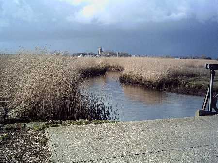
Mother Sillers channel dissapears into the reeds. At the end of this channel lies a path to the "Ship In Distress" Public House
The obvious and continual presence thoughout any visit to Stanpit Marsh is The bluff contour of Hengistbury Head which stands on the other side of the river. In fact, at the right time of the year, nearing sunset, with the sun low in the sky, Hengistbury Head is close enough to throw a shadow over the southern end of Stanpit Marsh.The river beach at the far southern end of Stanpit Marsh is separated from the Wickham Spires reed beds on the opposite bank by the confluence of the rivers Avon and Stour. Here, the rivers here can be quite fast flowing, and when running out it will easliy defeat anyone foolish enough to try rowing up stream (Not that I would have ever tried anything as silly as that, of course - honest)
Hengistbury Head as seen from the river beach on Stanpit marsh
Viewed from the river beach, the tower of the Priory stands out in the distance, beyond the confluence of the rivers Avon and Stour. The river Avon curves round to the right before the priory, whereas the river Stour curves to the left and continues past Christchurch Quay and onwards up to Tuckton and beyond.
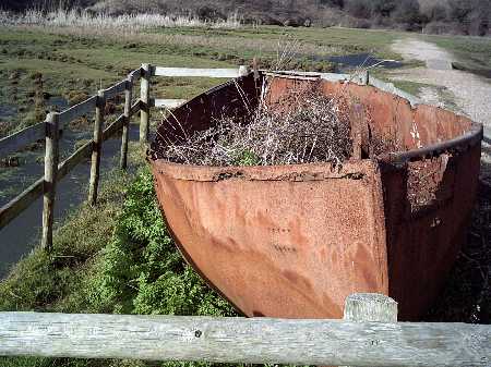
The path leads you over brackish ponds using old railways sleepers to span the water and waterlogged vegetation and on past an old and heavily rusted iron life boat.
The old Iron lifeboat must weigh a couple of tonnes. It once served a U.S. WWII Liberty ship. It was used locally in the early fifties until a storm in 1953 washed it across Priory Marsh to where it rests today. The boat was stripped and abandoned. After many years, rusting away, it has become one of the features of the Marsh is now enclosed with a fence. It is a sad old relic. The original Liberty Ship that it served must have gone to the breakers yard many years ago and this is the last remnant of a once proud wartime freighter, the name of which is today sadly, unknown.
(Many thanks to Lyndon Forster for the information.)
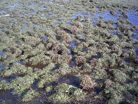
The grass growing in the water logged bog areas forms into tussocks
The old iron life boat on Stanpit marsh
Going on past the old lifeboat, you re-enter the Playing field and then its about 250 yards back down to the Scout Hut (named after the coastguard cutter of Battle of Mudeford fame - TS Orestes) and the car park.
Stanpit Marsh attracts many Ornithologists and ramblers but is generally one of the quieter areas within Christchurch harbour. Nature has been kinder to Stanpit Marsh than it has been to Hengistbury Head, although both have been abused within their time. Stanpit marsh at least now seems to be stable. Of course, if the worst happened at Hengistbury Head, and a breach formed through Barn Bight then there would be serious consequences for Stanpit Marsh, and the rest of Christchurch harbour too.
While in Stanpit, it is worth reviewing a few of the historic places there are there. For a tiny village it boasts quite an interesting and varied history. As already mentioned there is the Ship In Distress Public House and former landlady Hanna Siller (the Angel of the Marsh), famous for their close and notorious service to smuggling within the bounds of Christchurch in the 18th century. Next door to Hanna Siller and the Ship In Distress was the bootleg factory of Tobacco Racketeer and local bigwig John Streeter who, no doubt relied as heavily on Mother Sillers channel as did the local landlady.
Twenty years later Stanpit village gained prominence for a totally different type of industry. For a brief period in the early to mid 19th century Stanpit became one of the technological centres of its day. Young children were employed to manufacture miniscule chains known as fusee chains. These chains were an essential part of the chronometers used by seafarers and also used for the pocket watches of rich country gentlemen.
The sharp eyesight of the children was essential to make the tiny chains, although regrettibly concern for the childs eyesight and health often took a back seat to the drive to produce the chains. Small children being forced to manufacture the chains in all lighting conditions, even at time by candle light. As technology advanced the need for fusee chains waned and the industry died out shortly before the end of the 19th century. I recall being told that the main manufacturing centre for the fusee chains was in a row of buildings near the entrance to Stanpit Marsh and on the opposite side of the road to The Ship In Distress. These buildings are now cottages.